Baja California and the Northwest
A desert peninsula stretching 1,200 km, bordered by the Sea of Cortez and its grey whales, extending eastward into the canyons of the Sierra Tarahumara.
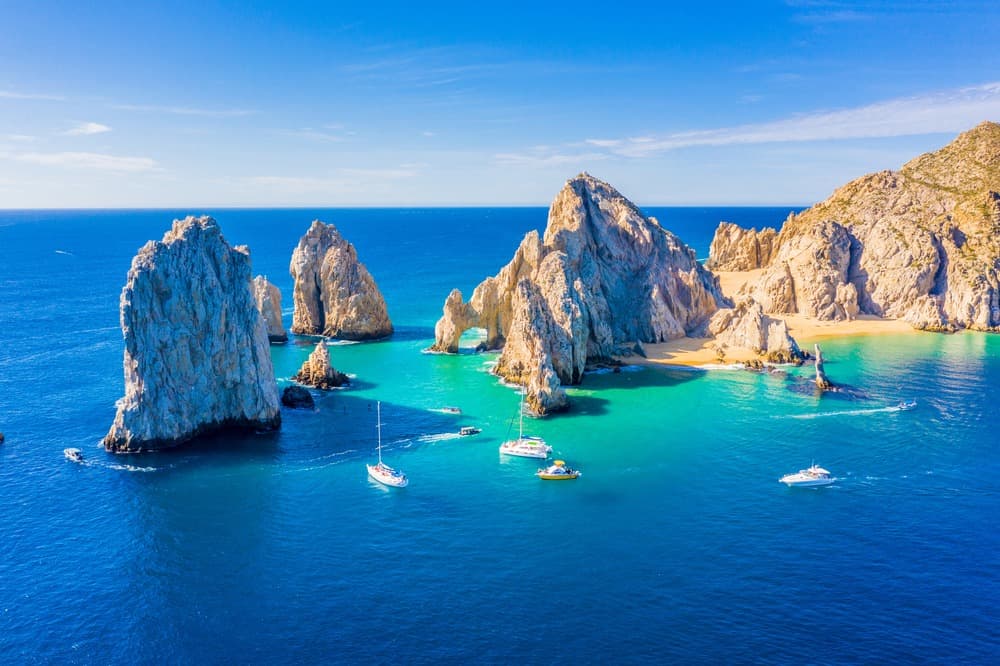
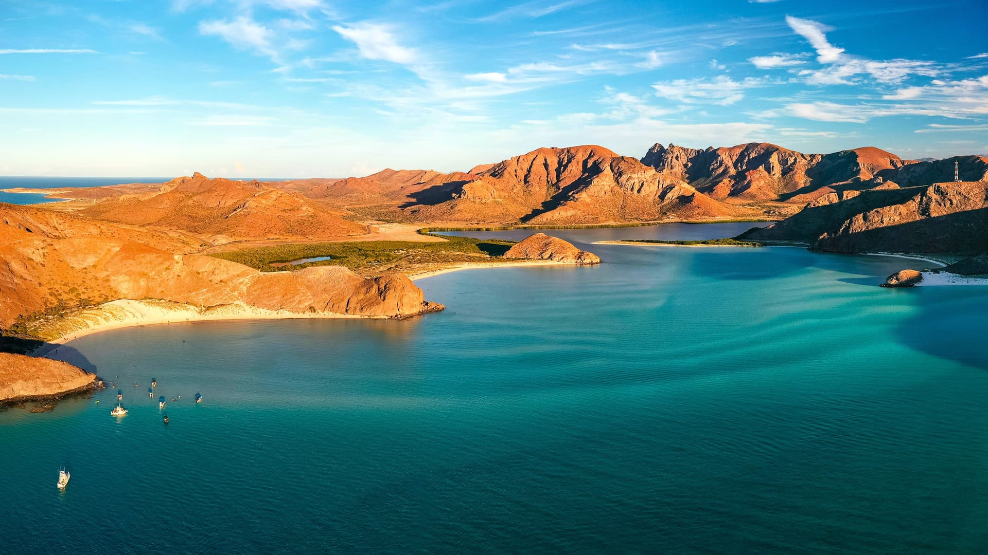
Baja California forms a 1,200 km peninsula separated from the mainland by the Sea of Cortez, the body of water that Jacques Cousteau called the world's aquarium for its density of marine mammals. It represents a geography apart within Mexique: no jungle, no monumental pre-Columbian pyramids, but rather a desert that descends to the ocean, volcanic sierras, giant cardon cacti (an endemic species exceeding 15 meters), and a dry light that transforms everything from morning to evening.
Administratively, the peninsula divides into two states—Baja California in the north, home to Tijuana and Ensenada, and Baja California Sur in the south with La Paz as capital and Loreto, San José del Cabo, and Todos Santos as key waypoints. We primarily work with the southern portion, wilder and better preserved. Beyond the strait, on the mainland, Mexico's northwest comprises the state of Sonora and Chihuahua, where the Canyon del Cobre (Barrancas del Cobre) rises—a system of six interconnected canyons deeper and more extensive than Colorado's Grand Canyon. The ChePe train connects Los Mochis on the Pacific coast to Creel and Chihuahua over nearly 650 km of track, crossing 86 tunnels and 37 bridges.
Marine fauna is the region's signature. From January to March, three lagoons along the Pacific coast—San Ignacio, Ojo de Liebre, and Magdalena—welcome grey whales traveling from the Bering Strait to give birth. Observation occurs by panga, eight-seat motorized skiffs, and the whales, often mothers with calves, frequently approach the boats of their own accord. This is one of the few places on Earth where contact happens at the animal's initiative. In the Sea of Cortez, at Cabo Pulmo, you dive into one of the eastern Pacific's sole coral reefs, protected as a national park since 1995. Near La Paz, the islet Los Islotes harbors a permanent colony of sea lions, and between October and April, whale sharks migrate into the bay to feed on plankton.
The interior tells another story. The Rarámuri people (Tarahumara) have inhabited Chihuahua's sierras since Spanish arrival forced them to the highlands. Approximately 70,000 strong, they live in dispersed communities around Creel, Batopilas, and Cerocahui, renowned for their long-distance running across hundreds of kilometers in huaraches (leather sandals). In Baja California, the rock paintings of the Sierra de San Francisco, UNESCO-listed, date back 7,500 years and depict human figures exceeding two meters, attributed to the now-extinct Cochimí.
The cuisine is marine and desert-born. In Ensenada, fried fish tacos line the streets—invented here in the 1950s. In La Paz, almeja chocolata, a clam from the Sea of Cortez, is served raw with lime and hot sauce. The Ensenada region and Guadalupe Valley now produce 70% of Mexico's wine, on vineyard lands established by Jesuit missionaries in the 18th century and revived by Russian Molkan immigrants in the early 20th.
The economy revolves around fishing, beach tourism (Los Cabos, Loreto, La Paz), maquiladora manufacturing at the northern border, and irrigated agriculture in Sonora's valleys. The pace here is slower than central Mexique, distances greater, villages fewer. This is a region best approached on a second visit to Mexique, after experiencing Mexico City, Oaxaca, or the Yucatán, when seeking a less populated Mexique oriented toward nature.
To Discover
Grey Whales of San Ignacio. Mid-January through late March, observe grey whales and calves by panga in the lagoon. Access is by dirt track from San Ignacio village; plan two days on-site for two outings.
ChePe Train and Canyon del Cobre. Rail journey from Los Mochis to Creel through the western Sierra Madre, with a stop at Divisadero for the overlook spanning the intersection of three canyons at over 1,800 meters of elevation difference.
Diving and Snorkeling at Cabo Pulmo. Protected coral reef, 20,000 years old, teeming with schools of jacks, mobula rays, and sea turtles. A fishing village without paved roads until the entrance, powered by solar energy, with seven family-run dive operators.
Rarámuri Communities Around Cerocahui. Meet families in the scattered canyon hamlets, visit the inhabited caves of Urique and Basaseachi Falls, Mexico's second-highest at 246 meters.
Guadalupe Valley. Around a hundred wineries between Ensenada and Tecate, tastings at Monte Xanic or Adobe Guadalupe, open-air chef-driven cuisine at Deckman's or Fauna, 90 minutes from the American border.
When to Go
The climate is arid desert, with sharp temperature swings by season and altitude. The ideal window runs October through May. In January-February, temperatures on the southern coast (La Paz, Los Cabos) hover around 23-25°C by day, cool at night (12-14°C), and it's peak season for grey whales on the Pacific coast. March through May, the Sea of Cortez gradually warms (20 to 25°C), ideal for diving. June through September, desert and La Paz temperatures regularly exceed 38-40°C, with a chubascos season (tropical storms) and cyclone risk between August and October, particularly in the peninsula's south.
In Chihuahua's canyons, altitude changes the equation. Creel sits at 2,340 meters: cold winters with possible snow from December to February (frequent night frost), temperate summers around 25°C. Canyon bottoms at Batopilas or Urique (500 meters elevation) remain warm year-round and impractical July-August. The best months combining high and low canyon are March-April and October-November.
Practical Advice
Budget a minimum of 8 to 10 days for the peninsula alone (domestic flights from Mexico City to La Paz, Loreto, or Los Cabos, roughly 2.5 hours), or 7 days for Canyon del Cobre via the ChePe train (arrival in Los Mochis from Mexico City, then Creel, Divisadero, Cerocahui over three to four nights). Combining both in one trip requires 14 to 16 days, as connections between peninsula and Chihuahua always route through Mexico City or Guadalajara. Internal distances are vast: 1,200 km from Tijuana to Cabo San Lucas via the Transpeninsular highway, few gas stations in places, car rental recommended only for the southern section (La Paz – Todos Santos – Los Cabos – Loreto).
Comfort varies considerably: luxury hotels in Los Cabos and boutique properties in Todos Santos or La Paz, established camps in San Ignacio lagoon (equipped tents with beds, shared facilities), rustic wooden lodges in Canyon del Cobre. This destination suits travelers returning to Mexique for a second time, nature enthusiasts, divers, marine wildlife watchers, and hikers. It combines poorly with the Yucatán or Chiapas on short trips (too many transfers), but articulates well as an extension of the Colonial Center for those with three weeks available.