Chiapas
From the cool plateau of San Cristóbal to the jungle-clad ruins of Palenque, Chiapas concentrates the highest density of living Maya cultures in Mexique.
Chiapas occupies the southern tip of Mexique, against the Guatemalan border. It is the wettest state in the country and one of the most indigenous: nearly a quarter of its inhabitants speak a Maya language, primarily Tzotzil, Tzeltal, Ch'ol, Tojolabal, or Lacandon. This cultural density, combined with a geography that shifts in two hours of driving from hot jungle to high-altitude pine forests, makes it one of the most contrasting regions in the country for our team.
Our anchor point is San Cristóbal de las Casas, the former Ciudad Real founded in 1528, nestled in a valley at 2,100 meters in the heart of the Altos. The town retains its colonial grid, its low adobe facades painted in warm tones, and a climate that surprises: 10–12°C at night in January, sometimes less. Around it, 10 and 12 kilometers away, the villages of San Juan Chamula and Zinacantán operate according to their own community rules. Chamula's church, with its floor carpeted in pine needles, copal incense and candles placed directly on stone, illustrates the Maya-Catholic syncretism that no guidebook can adequately summarize: we work with local Tzotzil guides for these visits.
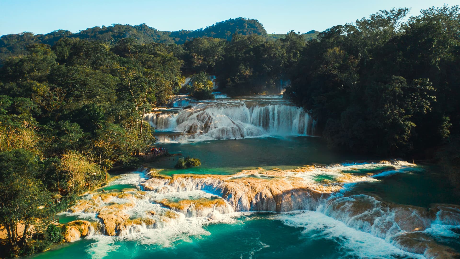
To the north, the road plunges sharply toward the Selva: 1,800 meters of descent over 220 kilometers to Palenque, where temperatures often exceed 32°C in May with saturated humidity. The Maya city, occupied between the 3rd and 9th centuries, remains hemmed in by forest; the roars of howler monkeys carry as far as the Temple of Inscriptions at dawn. On the return route or as a loop, the cascades of Agua Azul, fed by calcium carbonate-laden rivers, and the singular fall of Misol-Ha, 35 meters high, punctuate the day. Flow and turquoise color vary dramatically by season: after September rains, the water can turn brown for several weeks.
To the west, Sumidero canyon is navigated by lancha departing from Chiapa de Corzo on the Grijalva River. The walls reach 1,000 meters in height over roughly ten kilometers, home to Morelet crocodiles and vulture colonies. Further south, toward the border, the Montebello lagoons line up some fifty bodies of water in different hues depending on limestone beds and depth, at 1,500 meters altitude amid pine trees. El Chiflón waterfall, on the San Vicente River, often completes this southern circuit.
Chiapas cuisine differs markedly from central Mexique. Here you eat cochito horneado (pork marinated in spices and roasted), tamales de chipilín (a local leaf that flavors corn masa), and drink pozol, a beverage of fermented corn and cacao consumed fresh in lowland areas. High-altitude coffee, cultivated around Jaltenango and in the Sierra Madre of Chiapas, sustains an economy of small producers often organized into cooperatives, which we visit on request.
Chiapas remains a region where agrarian and political tensions are real, a legacy of the 1994 Zapatista uprising. Practically speaking, this means respecting certain photography rules in villages, working through local guides to enter autonomous communities, and accepting that some road access may be subject to community tolls. Our role is precisely to navigate these constraints with your itinerary.
Must-see
Church of San Juan Chamula. Floor carpeted with pine needles, hundreds of lit candles, Tzotzil rituals blending prayers in Maya, copal and Coca-Cola offerings. No photography allowed; visits must be accompanied by a community guide.
Palenque at opening. Entry at 8am, when mist still rises from the Temple of the Sun and howler monkeys can be heard from the forest bordering the Templo de la Cruz. Budget 3 hours on site; closed-toe shoes essential.
Sumidero Canyon by lancha. Two hours navigating the Grijalva between vertical walls of 700 to 1,000 meters, with stops near crocodiles and the waterfall called the Christmas tree, named for its tiered vegetation.
Zinacantán market. Tzotzil village specializing in greenhouse floriculture and weaving. Demonstrations of traditional belt-weaving in homes, meals of hand-cooked tortillas and chicken in local red mole.
Montebello Lagoons. Fifty lakes in shades of emerald to indigo depending on their beds, at 1,500 meters in a highland pine forest. Possibility of crossing the laguna Pojoj by balsa (wooden raft).
When to go
We recommend the window from November to April, which corresponds to the dry season. In San Cristóbal, daytime temperatures hover between 18 and 22°C, but nights drop to 5–10°C from December to February: pack a fleece, as colonial-era hotels are virtually never heated. In Palenque and the Selva, expect 28–30°C during the day year-round, with elevated humidity even in the dry season.
The months of June through October concentrate most rainfall, with a peak in September. Roads to Agua Azul or the Lacandons can be cut by rockslides, and the turquoise color of waterfalls vanishes for several weeks after each flood episode. May is the hottest month in Palenque, with peaks reaching 35°C before the first rains. Easter (Semana Santa) and year-end holidays bring strong Mexican tourism to San Cristóbal: accommodation reservations 3 to 4 months in advance are necessary.
Practical tips
We recommend planning a minimum of 6 days on the ground, ideally 8 to 9 to avoid chaining long drives together. Access is via either Tuxtla Gutiérrez airport (1 hour 15 minutes from San Cristóbal) or Villahermosa (2 hours 30 minutes from Palenque); the smoothest combination is to arrive at one and depart from the other, tracing the north-south axis without backtracking. Distances are short in kilometers but long in hours: 220 km between San Cristóbal and Palenque takes 5 to 6 hours by the direct road via Ocosingo.
Chiapas logically combines with Oaxaca and the indigenous south, via direct flight Tuxtla-Oaxaca or via Mexico City, to extend exploration of indigenous Mexique and regional cuisines. Combining Chiapas and Yucatán and the Caribbean is also common, passing through Palenque then Campeche by road. The region suits travelers curious about cultural matters, hikers (Sumidero canyon from above, Montebello lakes, the Lacandón community of Lacanjá) and archaeology enthusiasts. Hotel comfort is decent in San Cristóbal and Palenque, more rustic once you reach the Lacandón forest or communities. The region is not recommended, however, for those seeking beaches or a strictly resort-based rhythm.